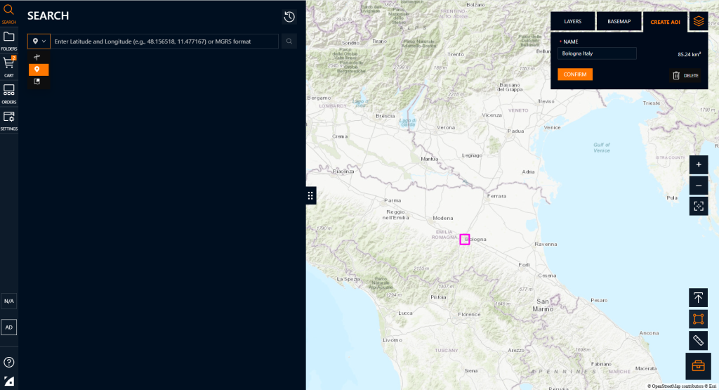
AOI Search
To perform a tasking or archive order, you must provide an AOI (Area of Interest), using one of the following methods:
- Draw the AOI: Use the polygon tool directly on the map interface.
- Upload an AOI file: Import a
.json,.geojson,.shp(zipped), or.kmlfile. - Enter coordinates manually: Input latitude and longitude values to define the AOI and then draw it.
- Search location by name and then draw the AOI on the map.
- Search by Catalog ID: if you already have the ID of the image, insert it
Apply Filters to Refine Your Imagery Search
Once you define your Area of Interest (AOI), you can apply the following filters to optimize your image selection based on mission or analysis requirements:
- Date Range: Select a specific time window to locate imagery acquired within that period.
- Sensor: Select from available platforms such as WorldView, GeoEye, or Legion, based on sensor characteristics.
- Datasets: Select the dataset you want between Radar, Hyperspectral, Optical, Thermal (Please note that currently only the optical dataset of Mazar is available for direct ordering through the platform. For the other datasets (thermal, radar, etc.), requests can be made manually by email).
- Spectral Bands: Filter imagery by available spectral bands, including Panchromatic, Multispectral, SWIR, and others.
- Resolution: Choose spatial resolution depending on the level of detail required (e.g., 30 cm, 50 cm).
- Cloud Cover: Filter results by maximum allowable cloud coverage to ensure clear-sky imagery.
- Area Off-Nadir (Min/Max): Define an acceptable range of off-nadir angles to meet imaging or processing constraints (0-90°).
- Sun Elevation (Min/Max): Set limits based on desired lighting conditions and shadow minimization.
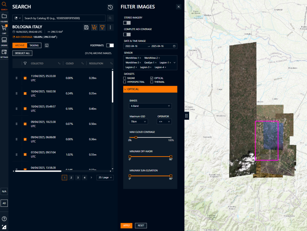
These filters help you efficiently identify the most suitable imagery for your use case, whether for analysis, monitoring, or mapping.